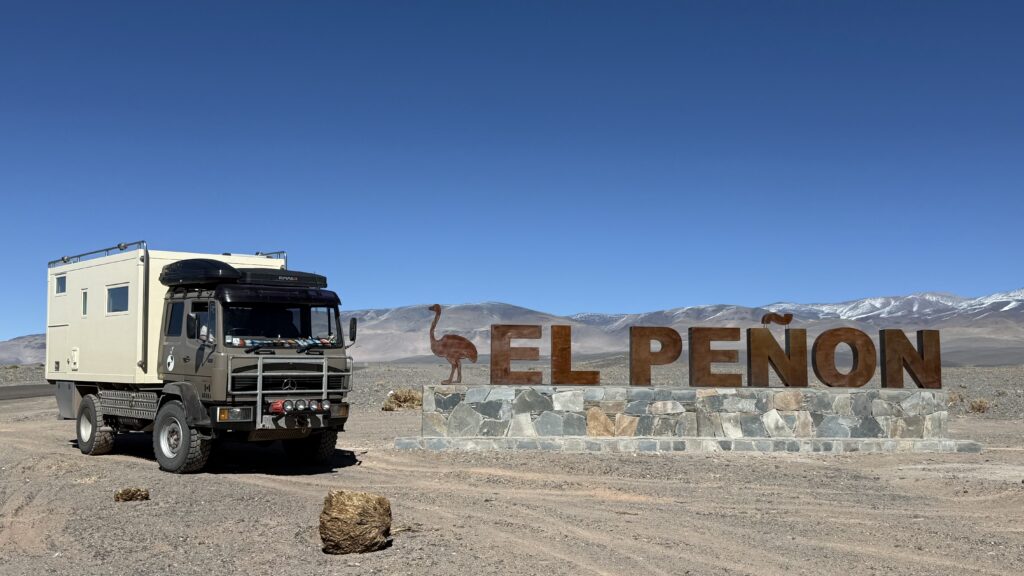
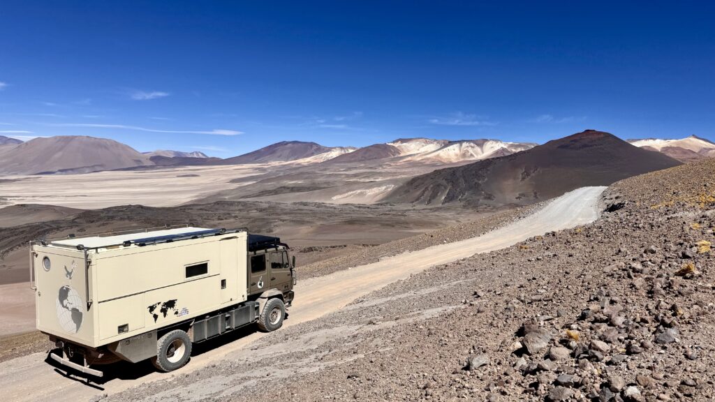
19 – 28 April, 2026. The Puna Route had been on our radar for a while—a remote, high-altitude crossing whispered about in overlander circles. From Belén, we set back out into the vastness, climbing steadily, past Laguna Blanca where we stopped for lunch before pushing on towards the tiny community of El Penōn, where we turned off towards the a landscape that was becoming increasingly otherworldly.
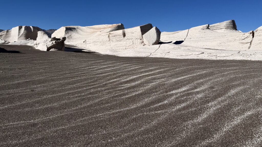
CAMPO PIEDRA POMEZ – PUMICE STONE
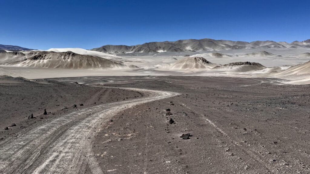
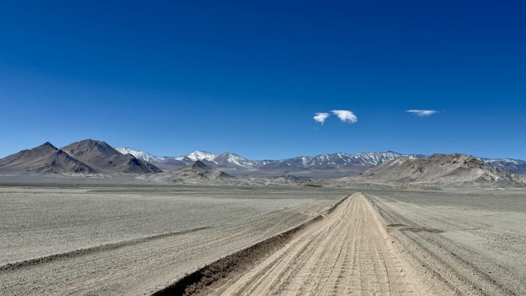
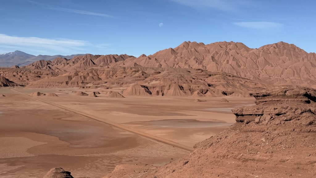
Following the dirt, sand and washboard road, we ventured off track hoping to make a short cut, only we ended up on a ridge above the road below. Doh! we had to back track, lucky it was only about 5km. By the time we reached the surreal white formations of Piedra Pómez it was later in the afternoon, the tours were gone so we had the place to ourselves, when the last people left it was just after sunset. The ever present wind didn’t let up till much later, but the outside temperature was so cold, likely below freezing with the wind chill factor, we just stayed inside and kept warm.
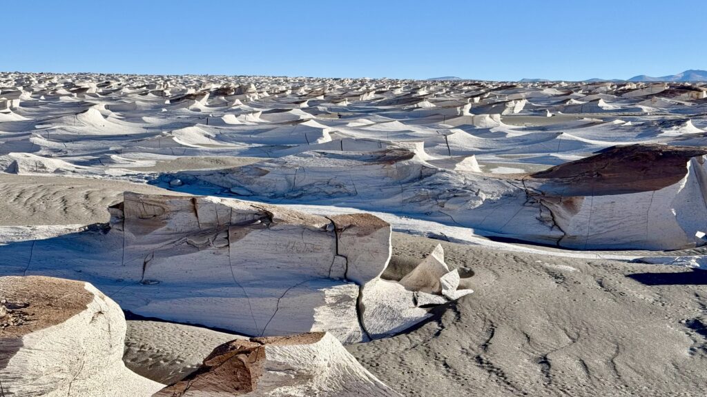
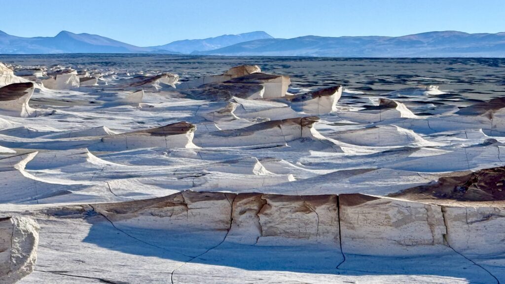
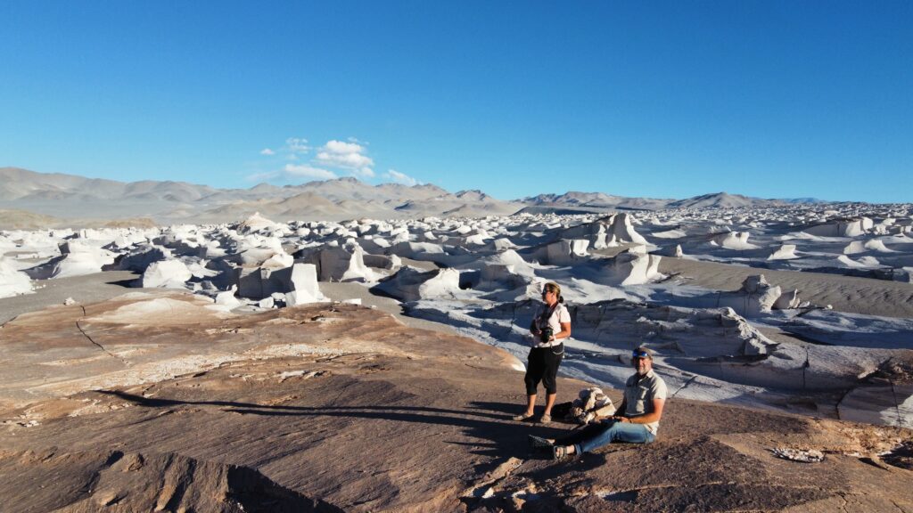
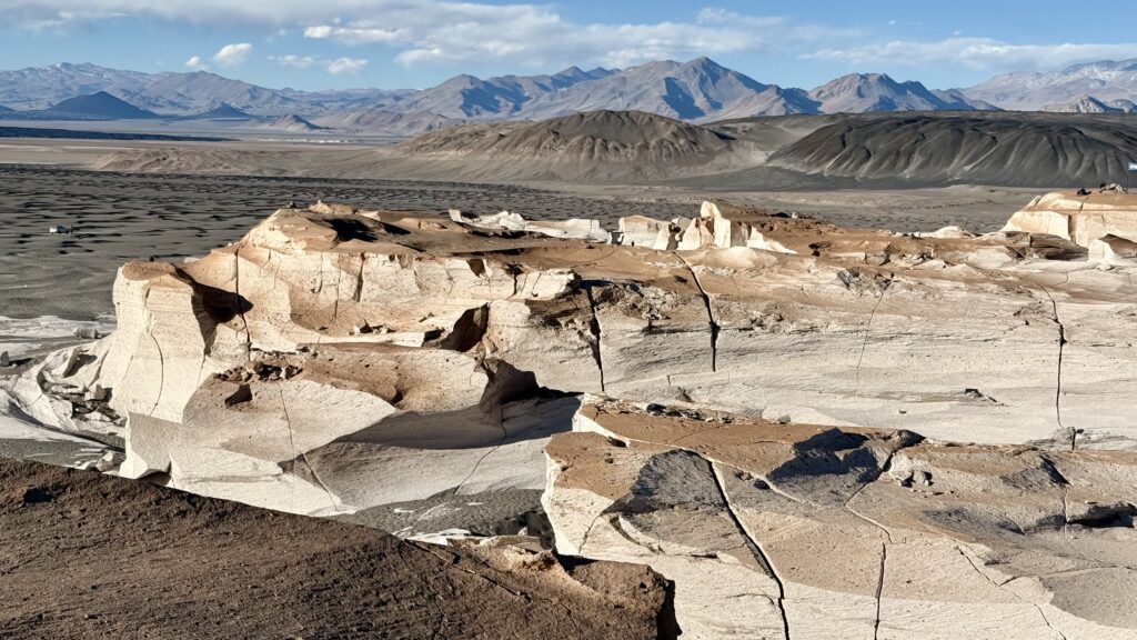
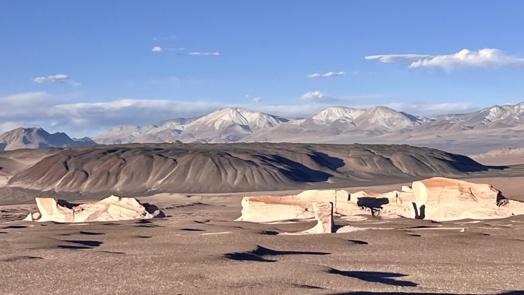
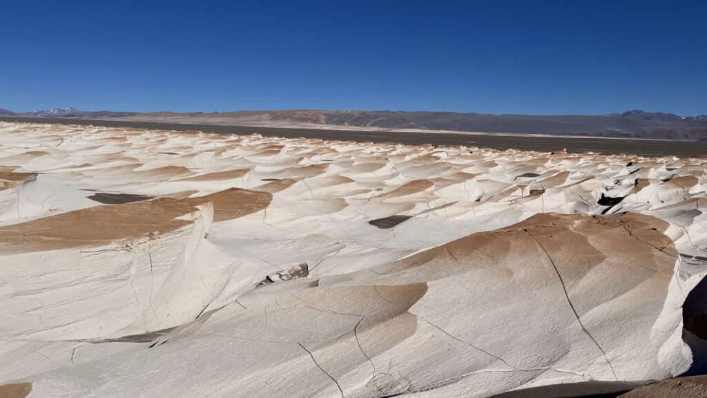
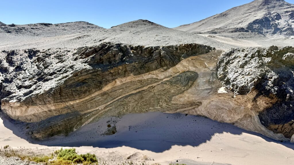
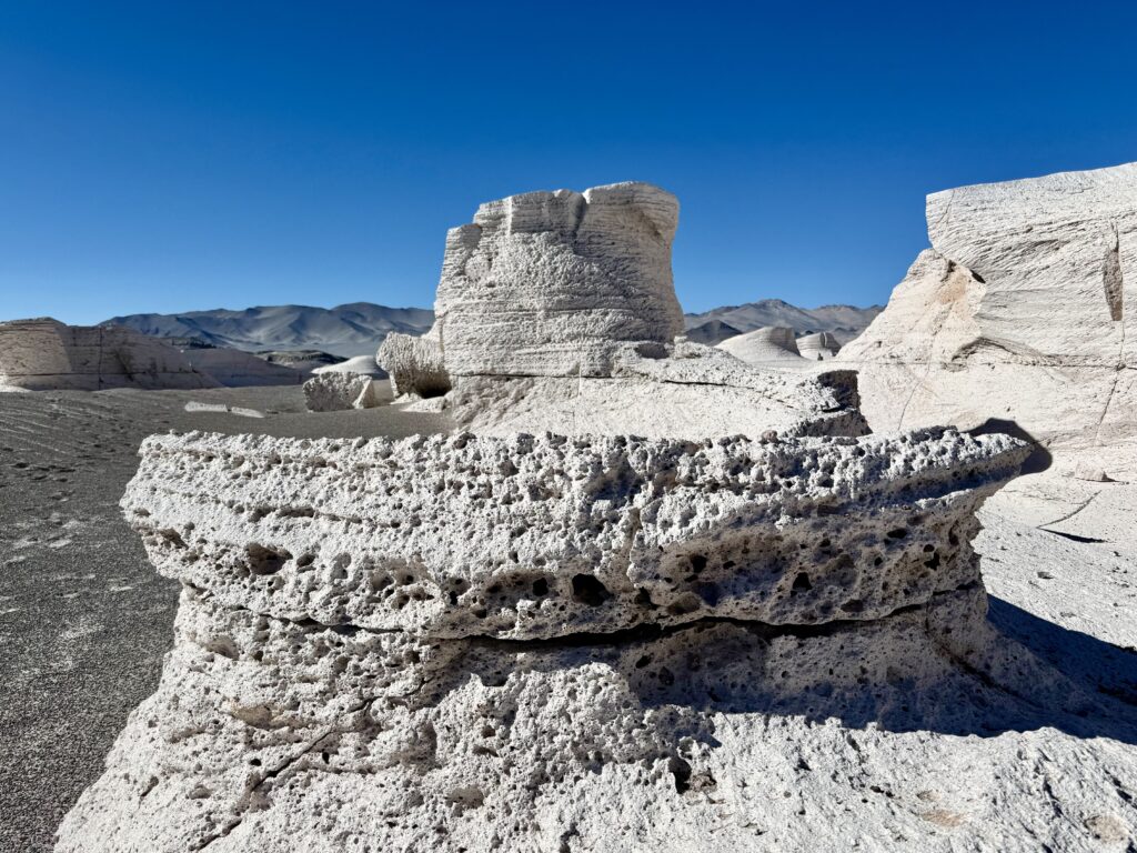
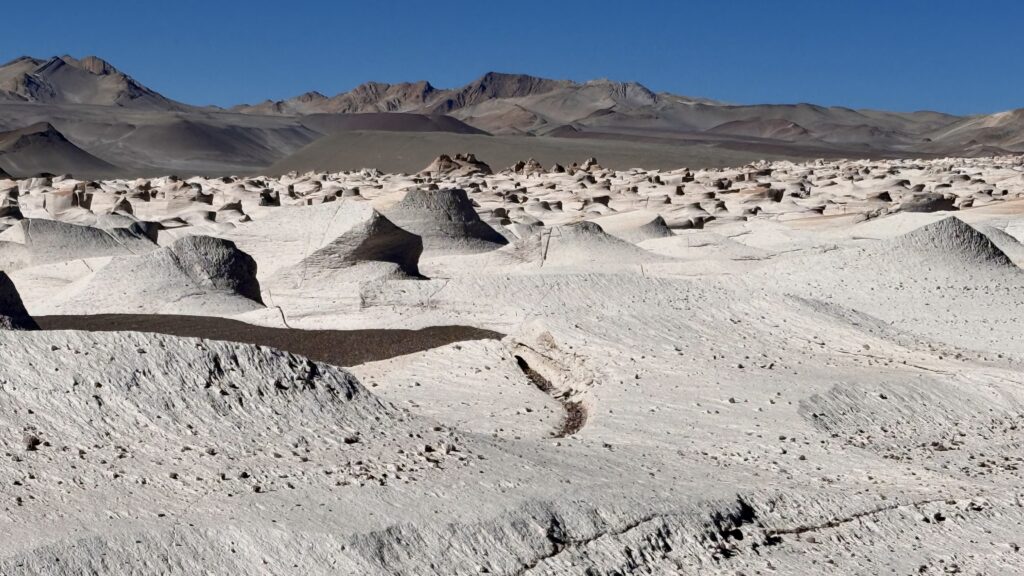
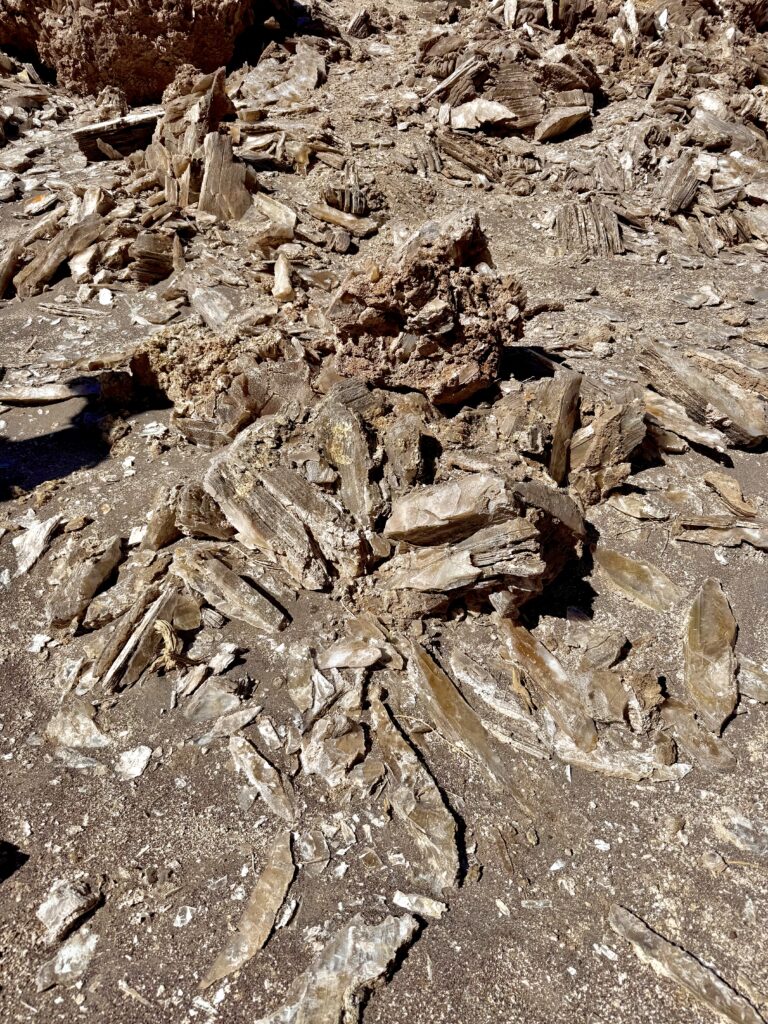
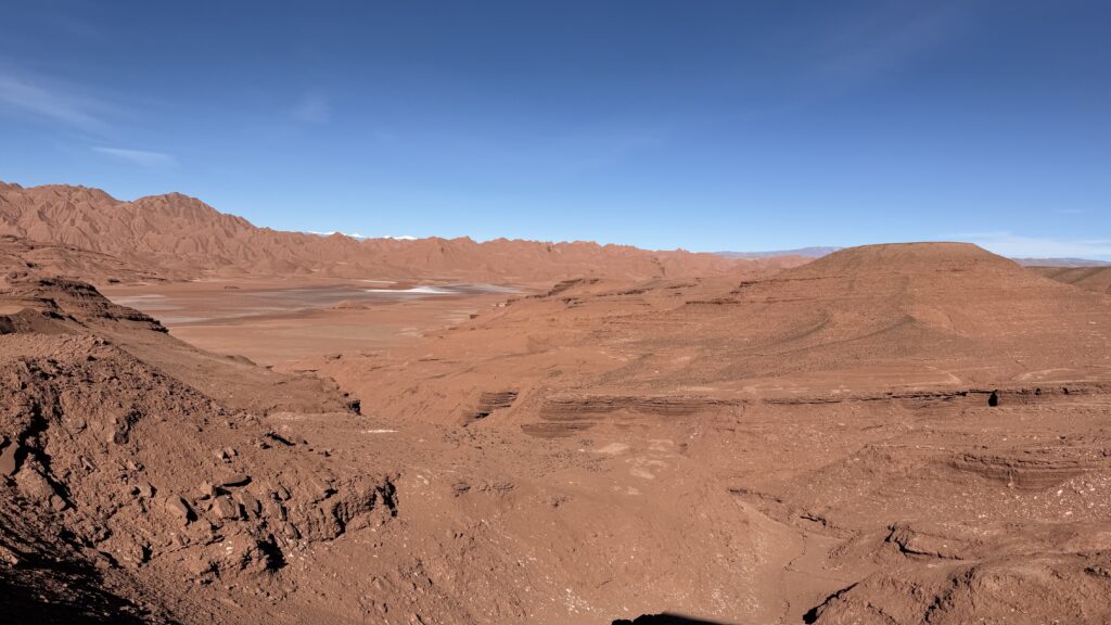
The Campo de Piedra Pómez is a strange and beautiful place where Mother Nature has been slowly sculpting these wind swept formations for thousands of years.
Its origins are rooted in explosive volcanic history. This region lies on the Puna Plateau, where the Nazca Plate subduction has fuelled intense volcanism for millions of years. Piedra Pómez was formed by massive eruptions which blasted ash and pumice across the landscape. When the material settled, it created thick layers of soft, porous rock called ignimbrite or pumice as we know it.
From there, the wind took over. At high altitude, with no vegetation to protect the surface, constant winds have carved the pumice into smooth ridges, deep channels, and towering white formations. The rock’s pale colour comes from its silica-rich composition, standing in stark contrast to the darker volcanic terrain around it.
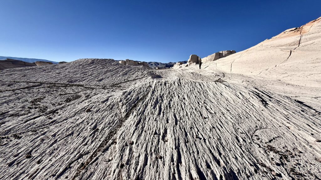
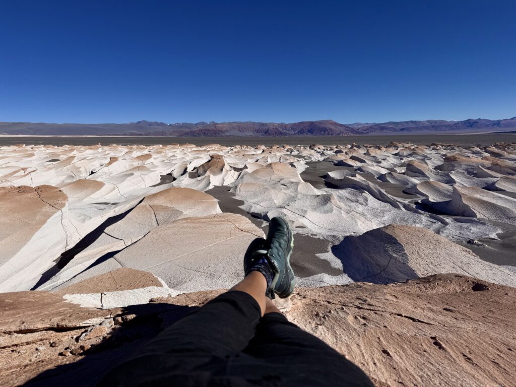
Enjoying the place to ourselves the following morning we walked and explored this huge area, sending out the drone to get some photos for perspective while we snapped from the ground.
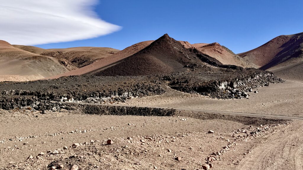
MINI VOLCANO HIKE
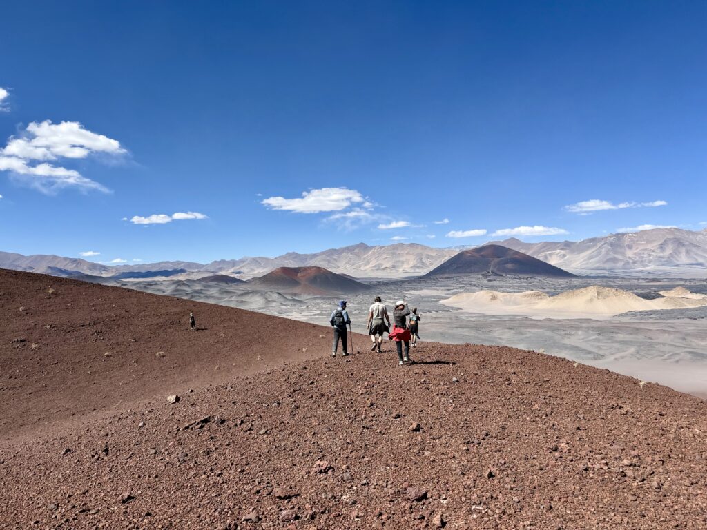
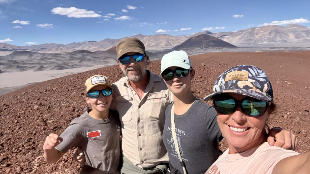
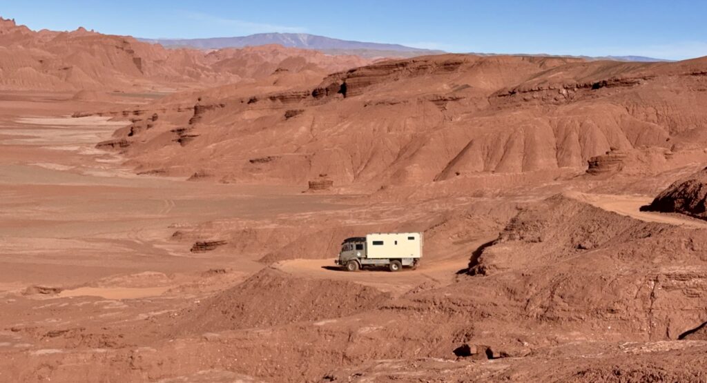
Further up the road, we caught up with the crew in Gwenda and Baloo. Parking the trucks, we scrambled up a small volcanic mound of soft red sand. Sweeping 360′ views from the top. A warm wind whipped around the rim, nudging us off balance before we eventually made our way back down. Rolling together into the small town of Antofagasta to a quiet back corner beside the soccer field, where travellers before us have camped.
ANTOFAGASTA
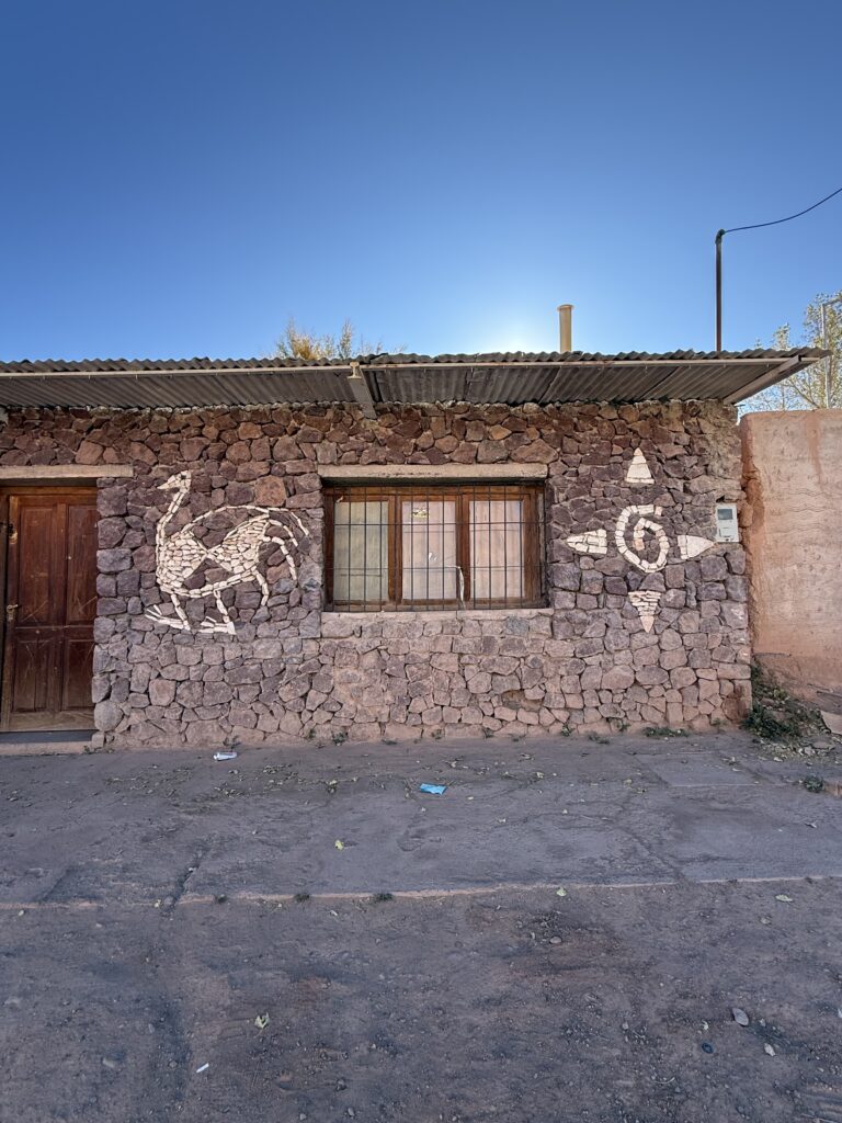
Sitting at over 3,200 meters, it’s surrounded by vast volcanic plains, black lava fields, and distant snow-dusted peaks. A handful of dusty streets, low adobe houses, and a small central plaza make up the heart of town. There are a few basic shops, a fuel station that opens occasionally, and little else in the way of infrastructure. Supplies are limited, cash essential. We found an open restaurant and waited while they made our collective order of 4 dozen freshly made, tasty empanadas.
After dinner, Jaxon joined a friendly soccer game with the locals. Feeling the altitude he was suffering a little, but enjoyed being able to kick the ball around.
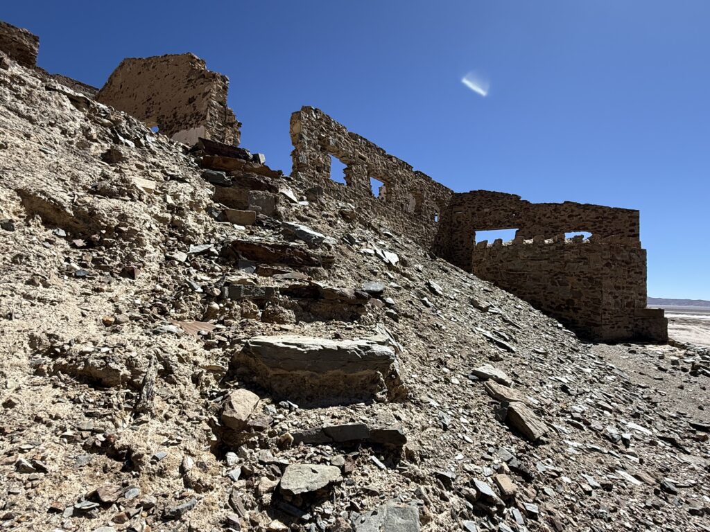
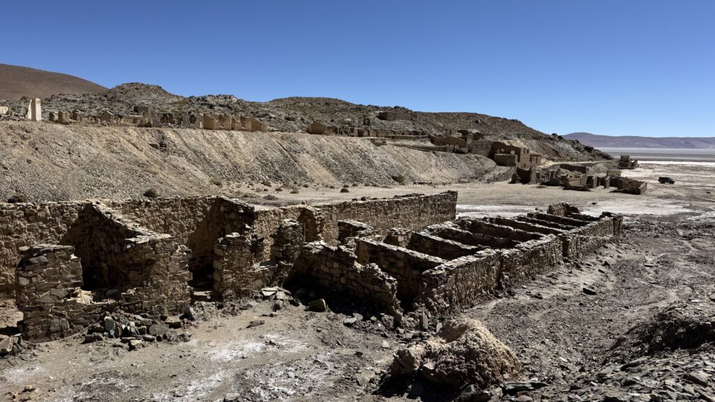
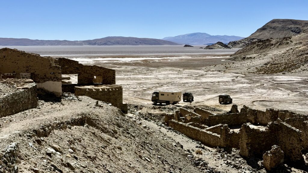
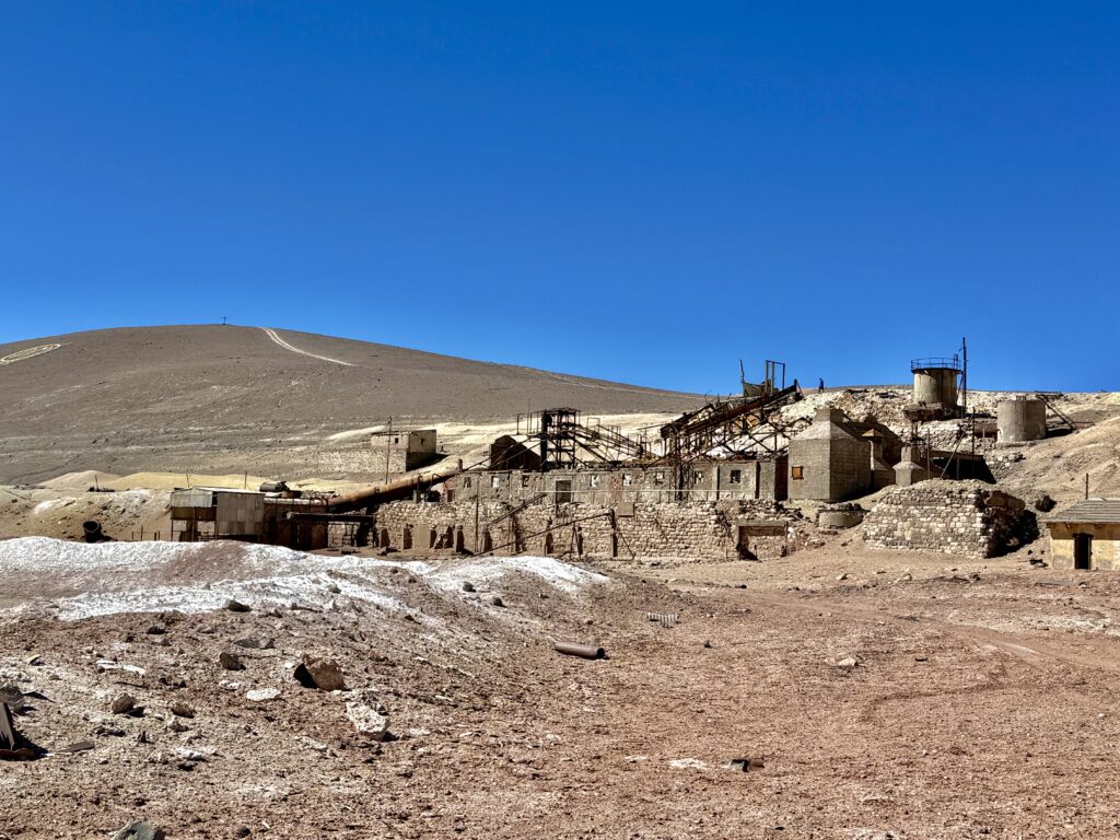
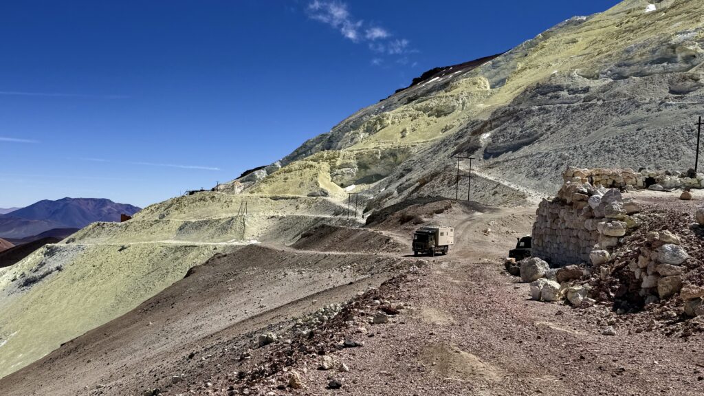
INCAHAUSI GOLD MINE
The next morning, our wee convoy of 3 set out together to explore the long abandoned Incahuasi gold mine.
Perched high on the flank of a solitary volcano, the mine is a forgotten outpost from another era. Taking its name from the Quechua “Inca Huasi,” meaning “House of the Inca,” it hints at the Inca Empire presence in the region. While the Incas likely passed through or used the area as part of their high-altitude network, the ruins visible today are from much later mining efforts.
The site was developed in the late 19th and early 20th centuries, when prospectors extracted gold from quartz veins in the surrounding volcanic rock. Harsh conditions, isolation, and altitude made life difficult even at the best of times, eventually leading to its abandonment—leaving behind rusted machinery and crumbling structures slowly being reclaimed by the elements.
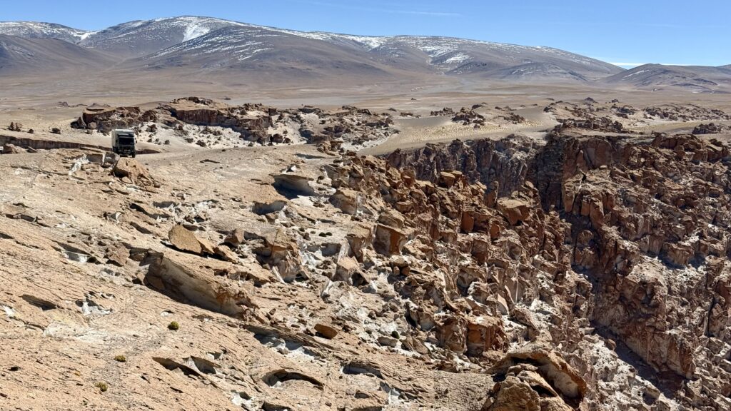
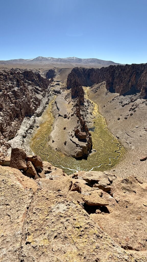
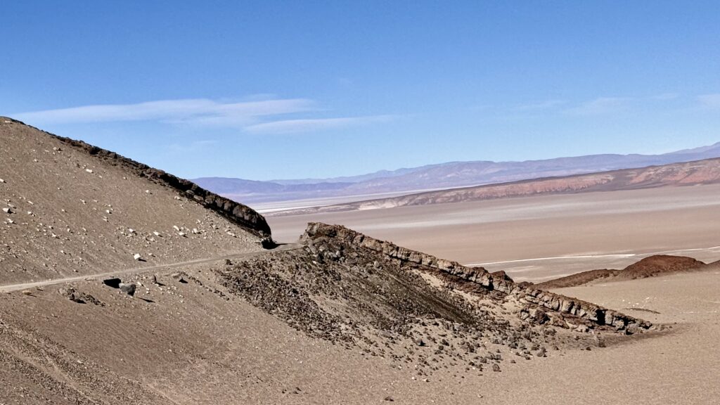
HORSESHOE CANYON
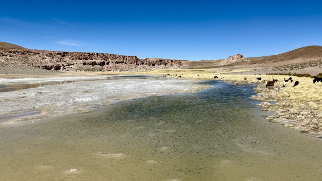
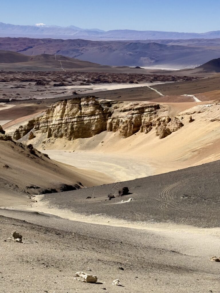
From there, we continued along the well maintained mining roads out towards the spectacular Horseshoe Canyon—a surprising green oasis carved deep into the earth. Far below the arid plateau, vegetation thrived around a squiggly green ribbon of water. The frigid wind, however, was relentless, threatening to knock us sideways as we stood on the rim. Above us, eight condors circled, riding the thermals, disappearing and reappearing in the afternoon light. We sat and enjoyed the view for an hour, but too high to camp at 4,350m we had to descend to get a good night sleep.
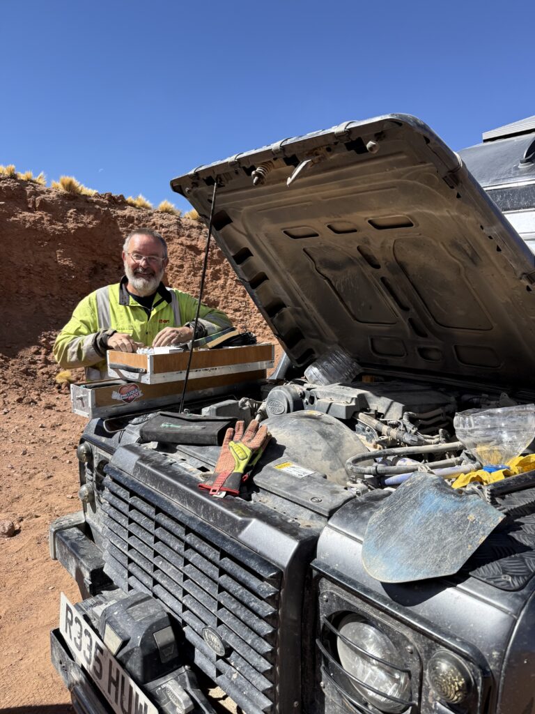
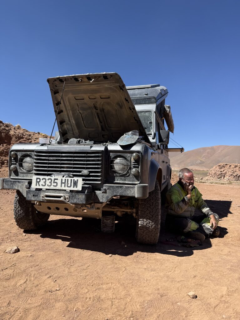
LAND ROVER BREAKDOWN
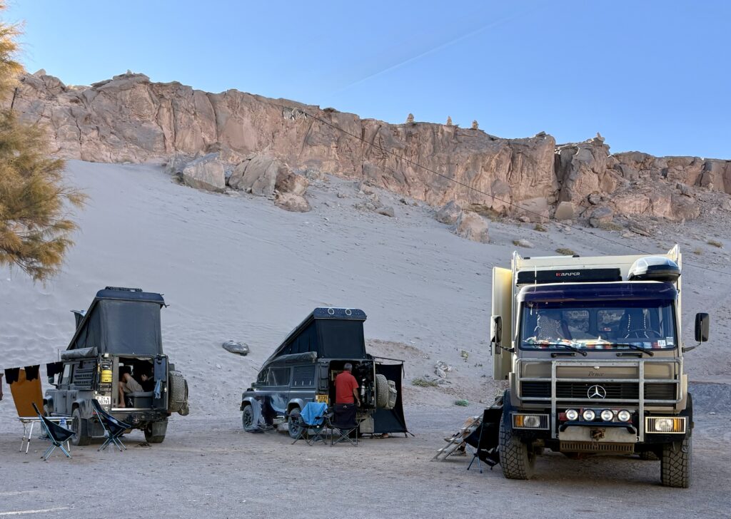
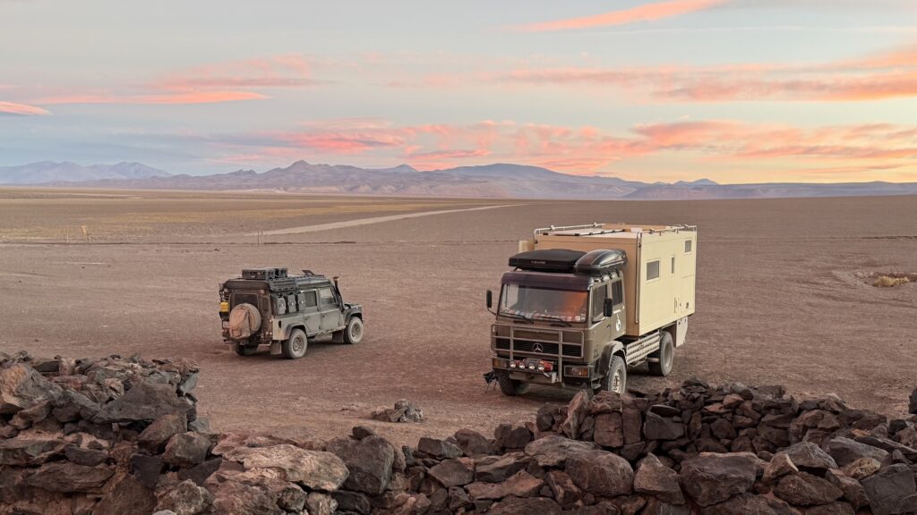
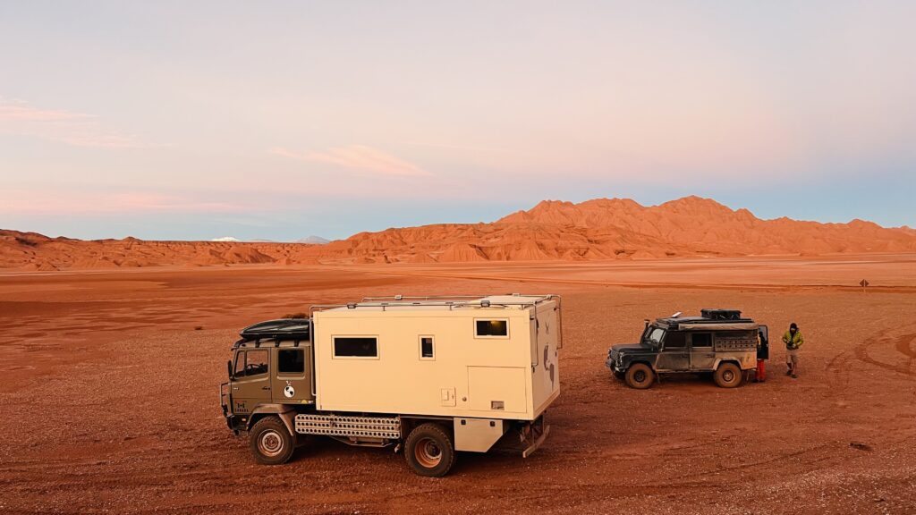
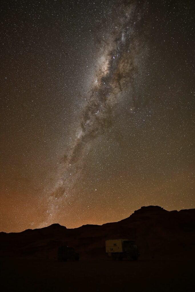
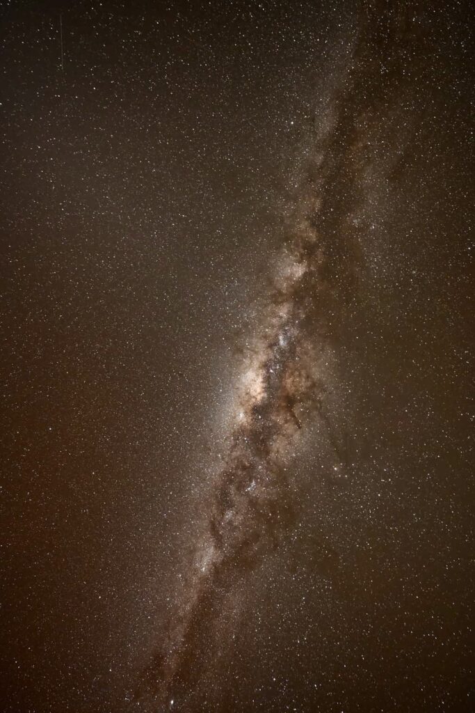
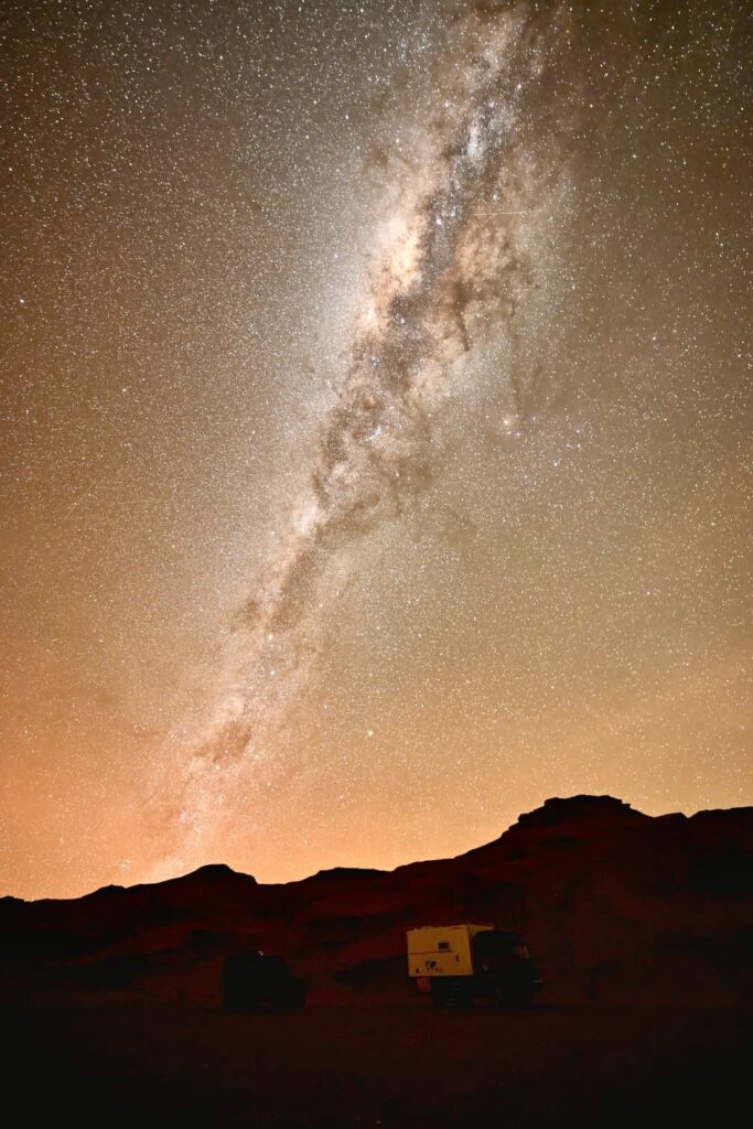
That night, we tucked ourselves into a hidden desert camp, sheltered from the road, nestled amongst some interesting rock formations and beneath a billion stars in the night sky. The temperature dropped quickly after sunset. Each of us disappearing into our campers to keep warm. I’m grateful once more for the size, comfort and warmth of our camper box. No roof top tent for the kids tonight.
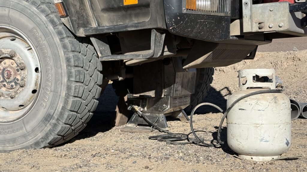
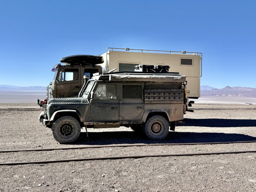
Morning came with a reluctant truck—Bruce refusing to start in the high and cold. Coughing out clouds of black smoke, Tim gently coaxed her back to life. The Land Rovers were gone, a distant cloud of dust was all we could see. We’re bigger and slower, but that’s ok, because slow and steady works.
On the return toward Antofagasta, things took a bit of a turn. Cresting a rise we see the two Land Rovers pulled over. Sara shaking her head, Gwenda wasn’t sounding right. Baloo towed her to a safe pull-off while Huw got to work diagnosing the issue. But this time, it wasn’t something he could fix roadside. Poor Gwenda doesn’t sound.
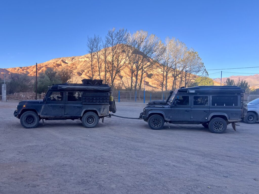
We pushed on in hopes of finding a tow truck in Antofagasta only 30km away. Hours later—and somewhat humorously—Baloo ended up towing Gwenda all the way back using a “straight” bar that was anything but straight, and certainly not up to any recognized standard. Somehow, though, they made it in one piece. No small feat for a 3.5-tonne Land Rover being pulled with effectively zero braking power.
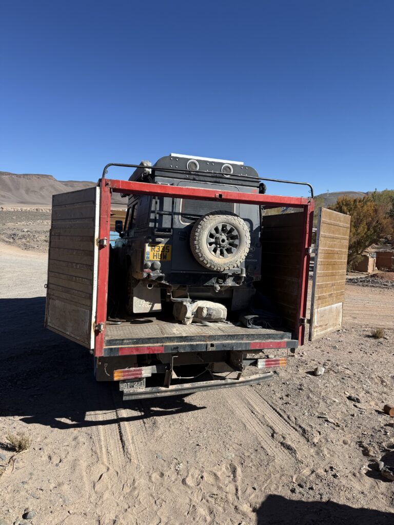
By morning, Gwenda was being loaded onto the back of a cattle truck, bound for Salta and a Land Rover mechanic. We said our goodbyes, sure our paths would likely cross again in Salta a few days from now.
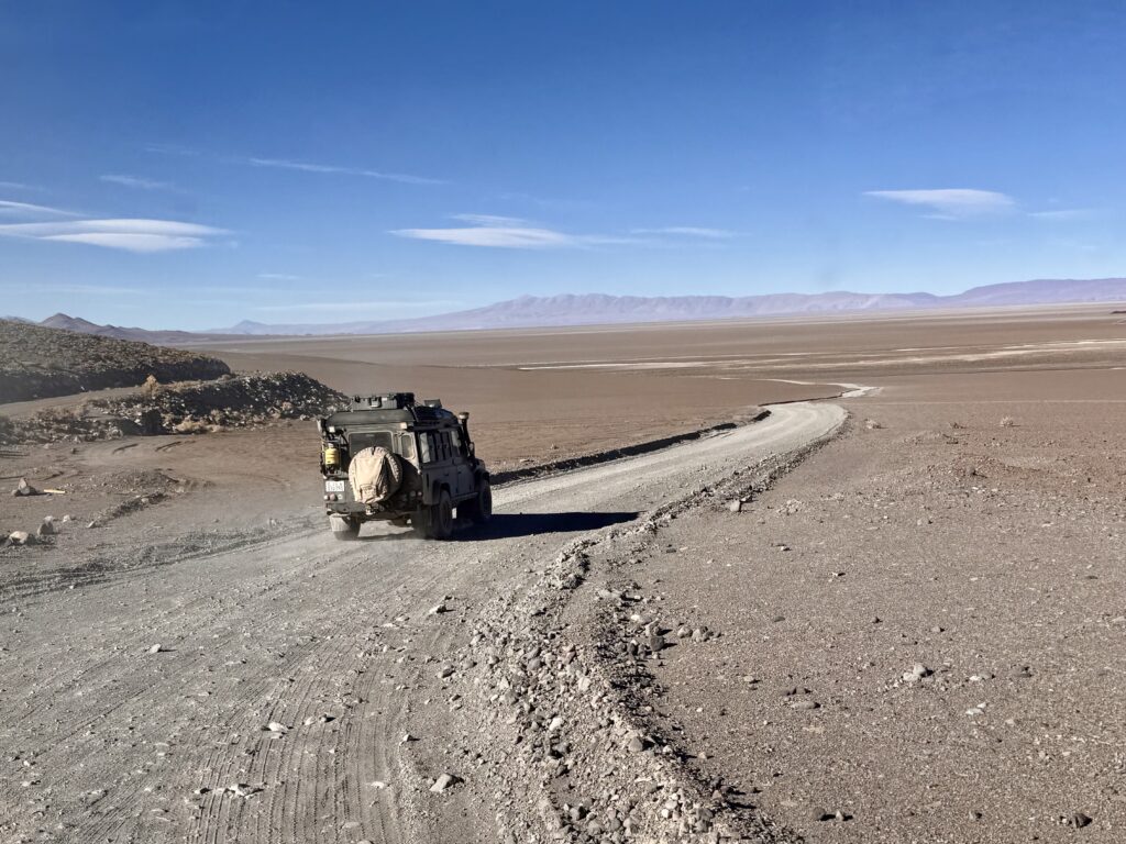
With just the 2 of us continuing on, Antofagasta became our final fuel and food stop for the next 900km. Diesel wasn’t easy—cash only, and expensive. We’d calculated carefully, but hadn’t accounted for the previous day’s detours. Not wanting to risk it, we topped up an extra 75L at double the usual price, plus a hefty ATM fee for the privilege.
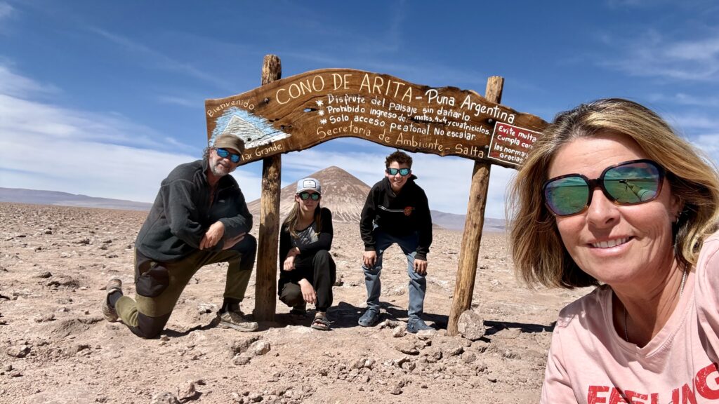
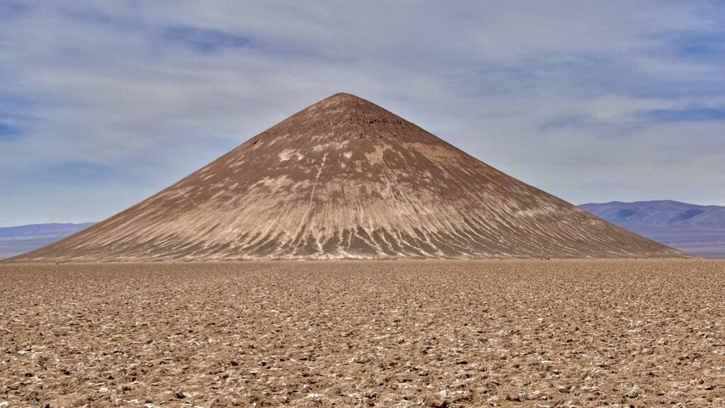
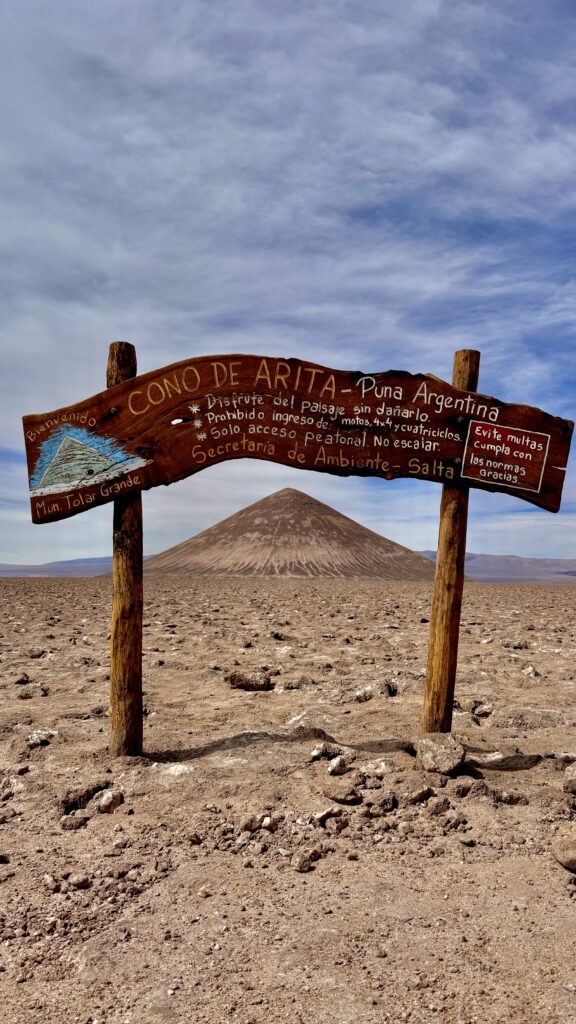
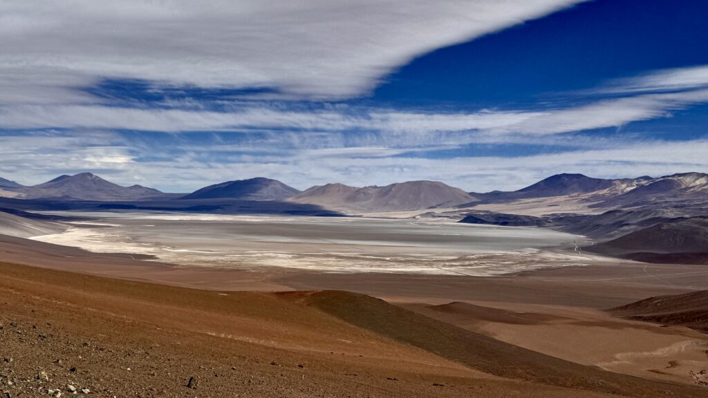
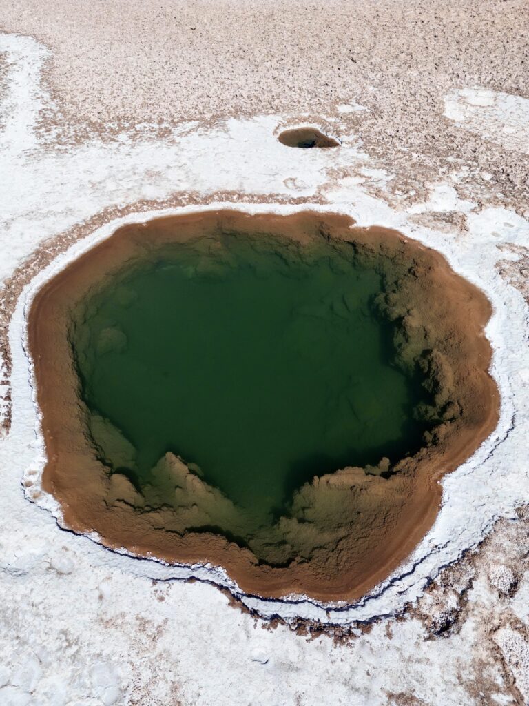
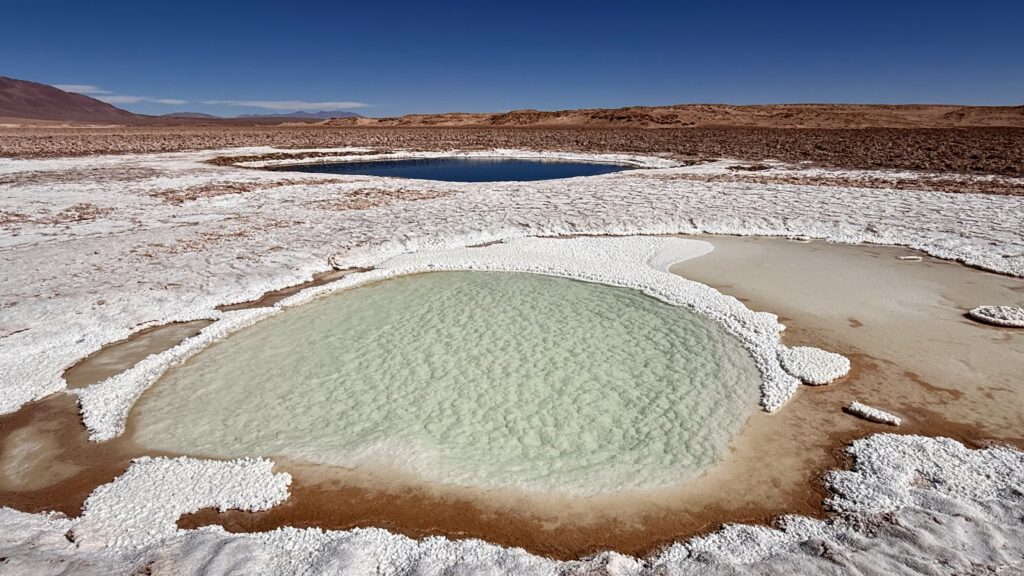
CONO DE ARITA
Airing down the tires, we headed out – over rough roads and up a high pass with sweeping views. The landscape opened up as we pushed deeper into the desert, eventually arriving at Cono de Arita. Rising sharply from the salar floor, this near-perfect cone-shaped formation is a geological curiosity—likely formed by volcanic processes, though its exact origins, according to google, remain debated.
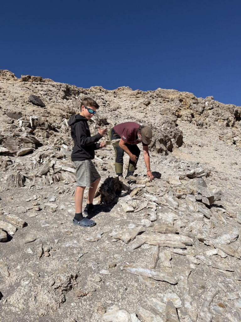
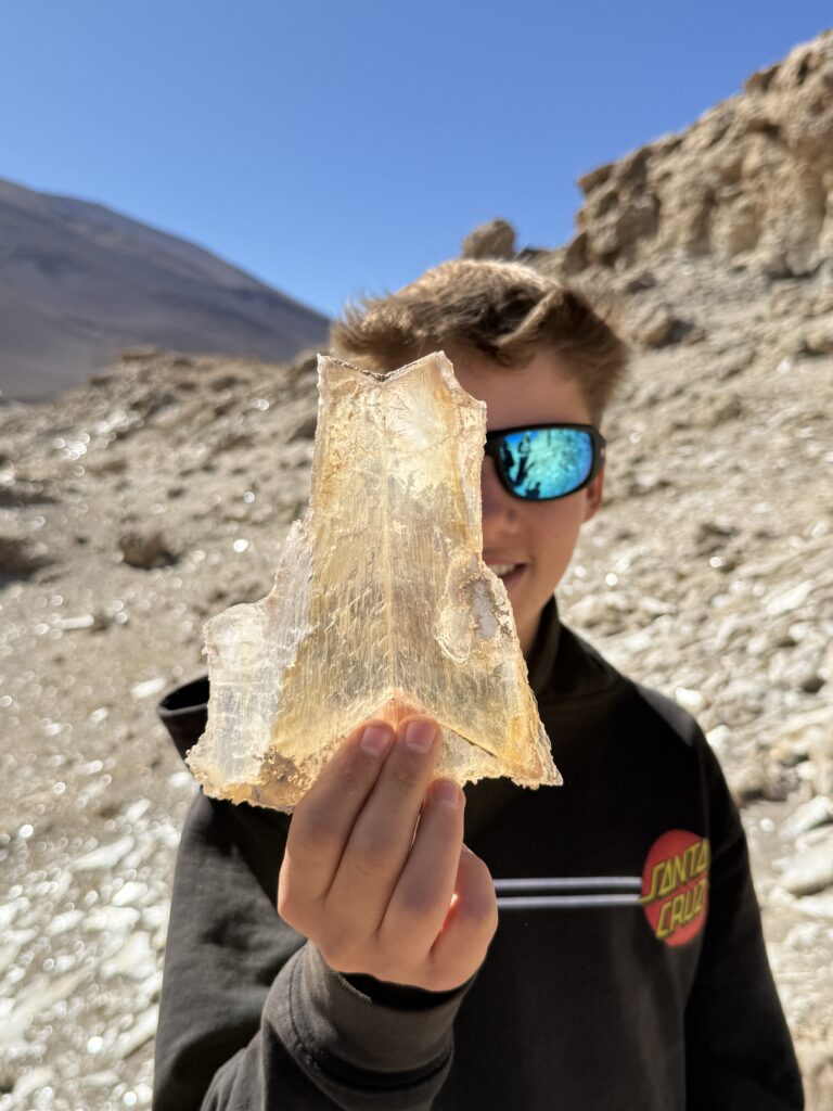
A quick stop along the way to check out a ridge that was sparkling as we drove by. Turned out to be a vein of Mica, strange looking crystals that grown in layers in all sorts of directions, their paper-thin layers catching the sunlight like scattered shards of silver and gold. Up close, they looked like delicate sheets of glassy mineral stacked together in shimmering folds.
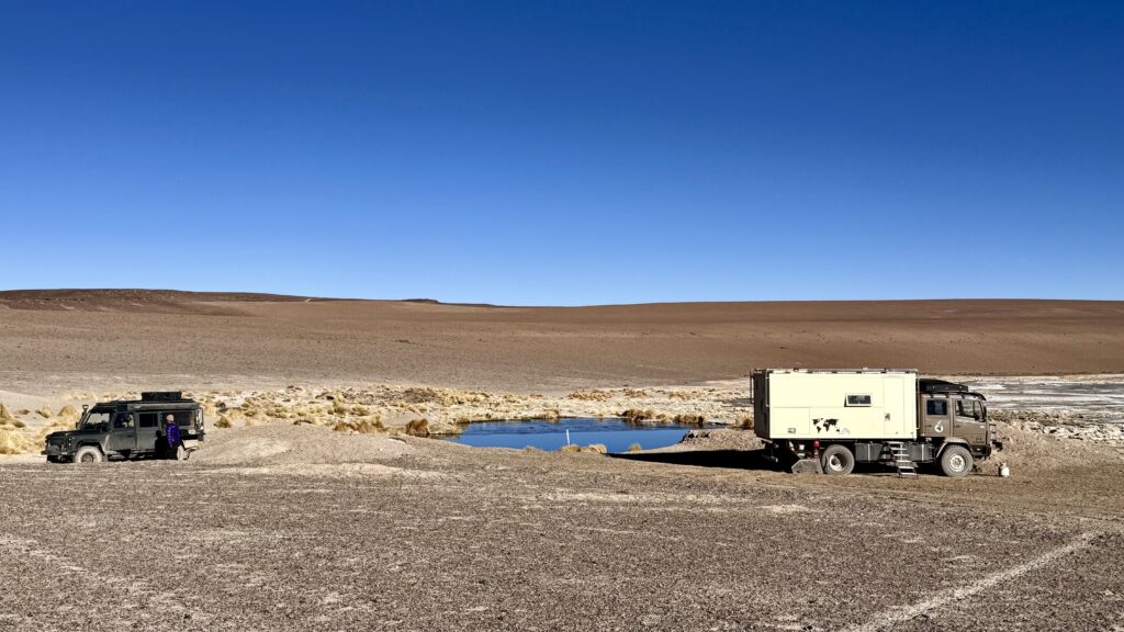
We camped nearby at the edge of a small freshwater lagoon, where Pascale and Kevin introduced us to a new obsession: the game “Dog.” A mix of cards and strategy, played with a wooden board & pegs. It’s all about luck of the cards, timing, teamwork, and just the right amount of sabotage. Progress around the board depends on the cards you’re dealt, but knowing when to hold back—or send someone else backwards—is where the real game lies.
Morning brought -5°C temperatures at 4,082m. Bruce was, once again, reluctant. Tim fired up the BBQ and slid it under the engine to warm the oil pan—a bush fix that worked. By 11am, we were rolling.
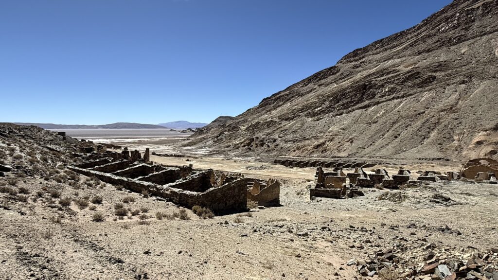
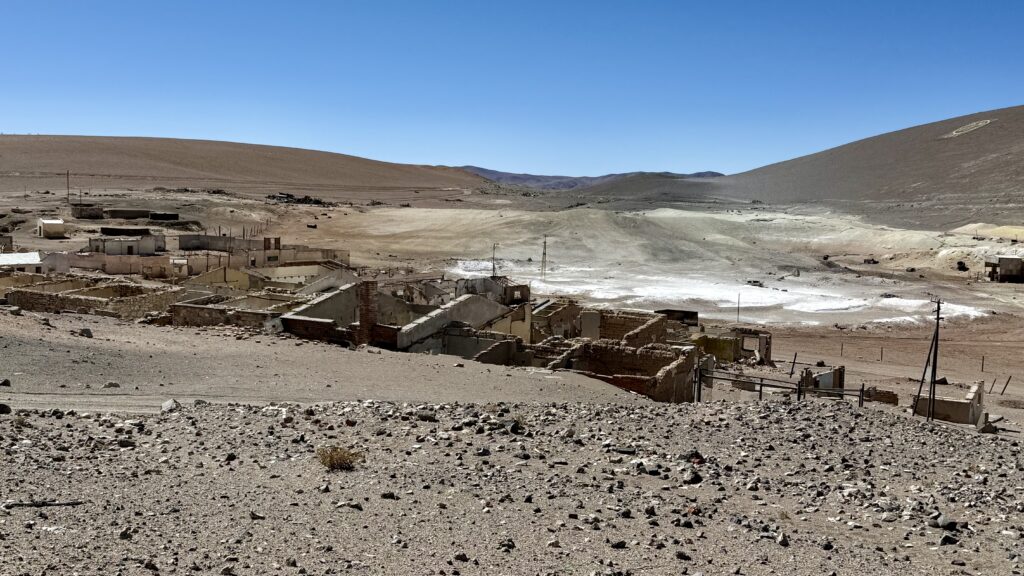
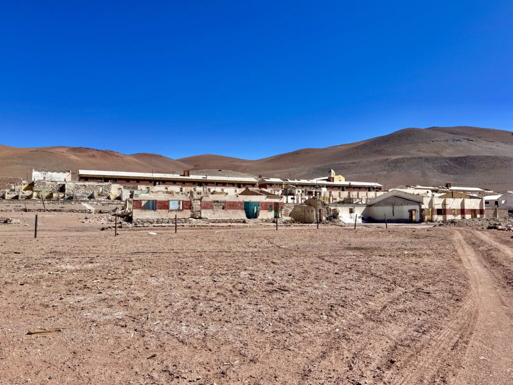
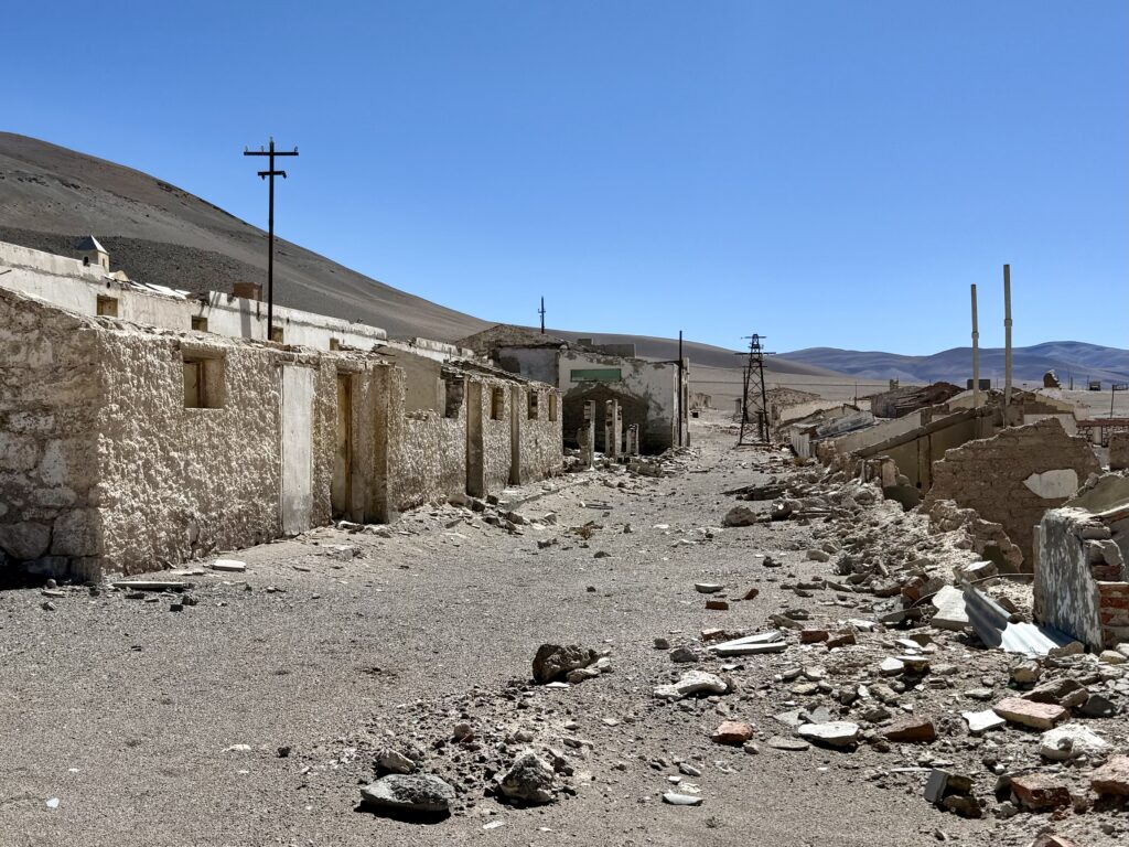
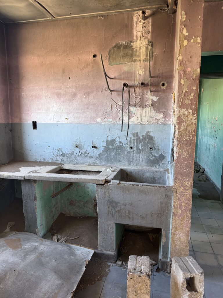
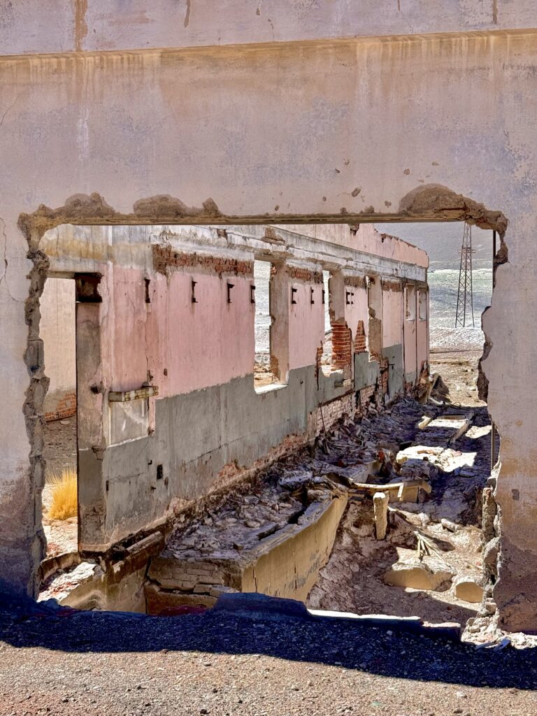
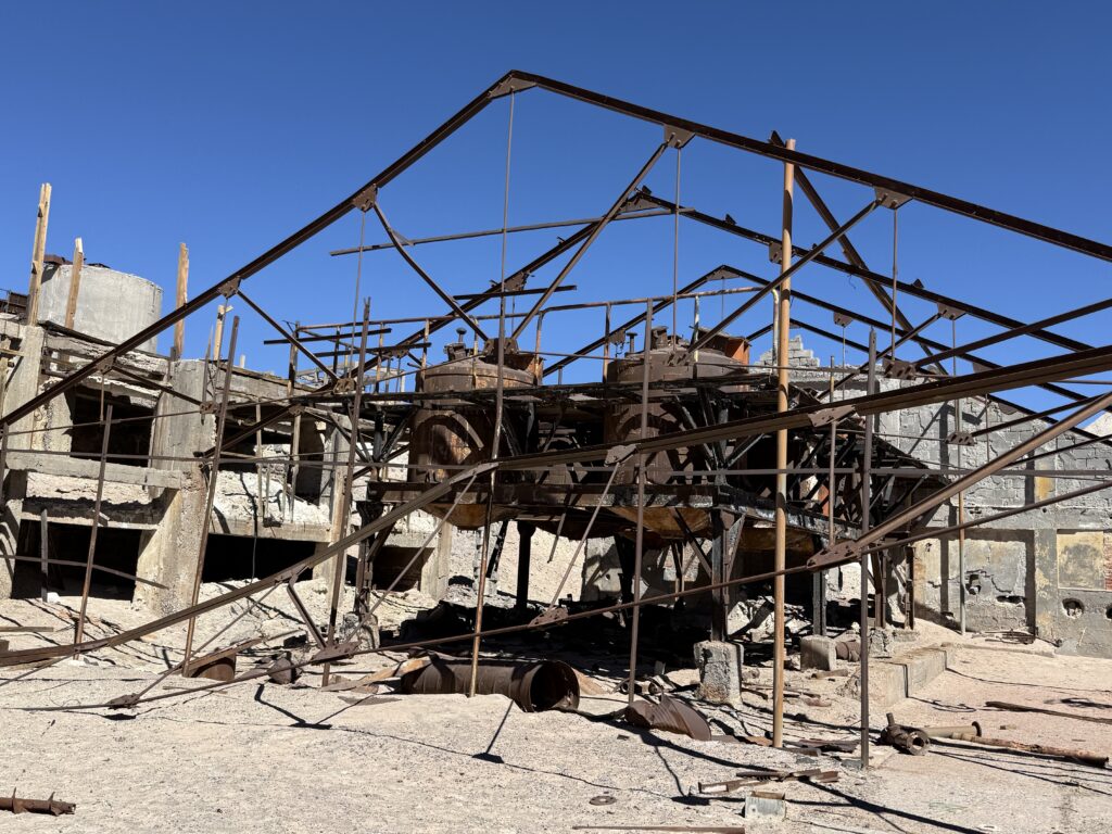
MINA CASUALIDAD
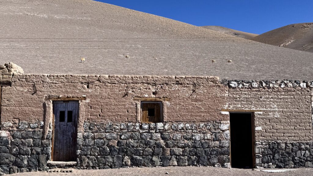
Our route took us to Mina La Casualidad, an abandoned mining town once dedicated to sulfur extraction. Built in the 1950s, it was a fully functioning settlement, home to roughly 3,000—complete with homes, a hospital, and even a cinema. Today, it lies in ruins. Empty buildings stand as echoes of a once-thriving community, slowly eroding under the harsh desert conditions.
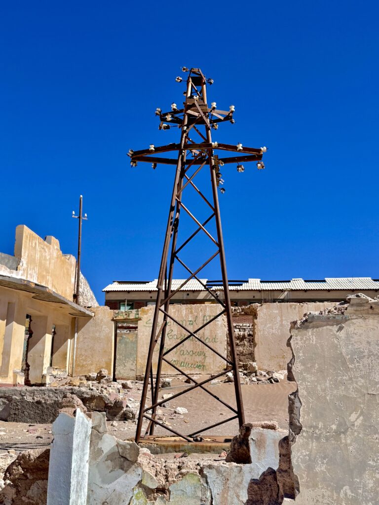
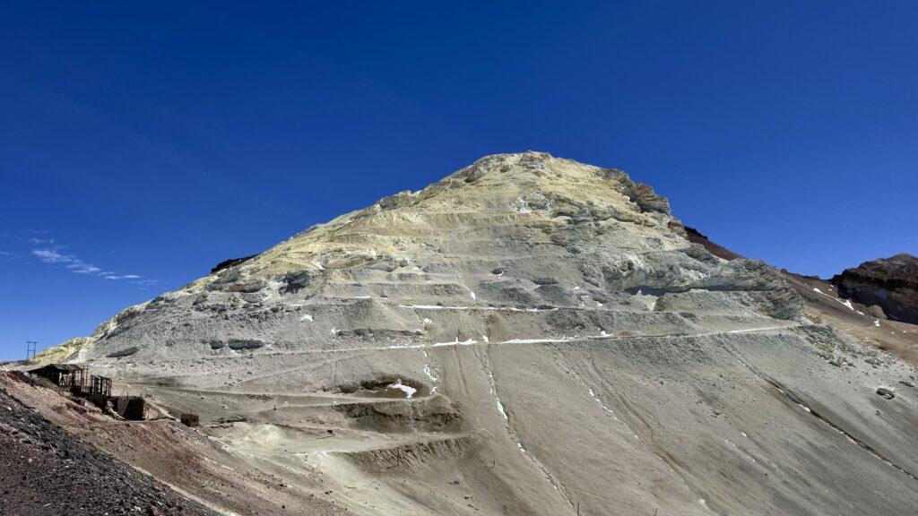
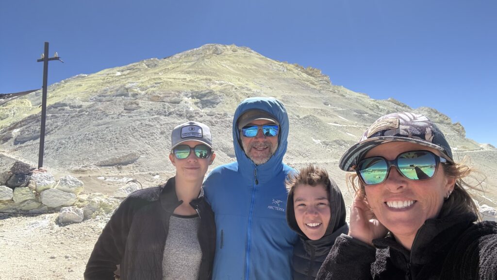
From there, we climbed higher—up to 5,388m—to Mina Julia. The air was thin, the wind biting. This old sulfur mine clings to the mountainside, surrounded by debris and remnants of industry. Rusted towers mark the route of a 25km cable system that once transported sulphur down the mountain to Mina Casualidad in hanging buckets. On the edge, and slightly inside the Chilean border, we felt the full weight of the altitude—lightheaded and breathless.
My guess is that both the mines screeched to a halt at the same time. People gathered their belongings and just left. Slowly infrastructure started to collapse, vandals destroyed what they could, leaving the rest to time and the elements.
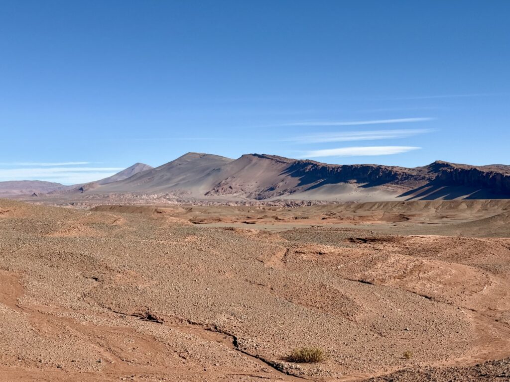
All around us, volcanoes dominated the skyline—vast, silent, and streaked with colour. Red, ochre, yellow, and grey folded into each other, shaped by time and fire. Lava flows spilled across the land where vents had once torn open the earth.
We spent the night at 4,000m at the base of one such volcano, the silence broken only by the wind.
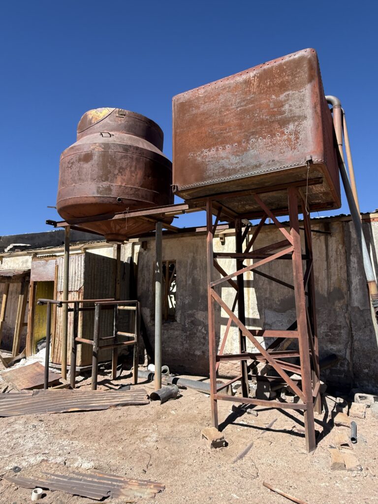
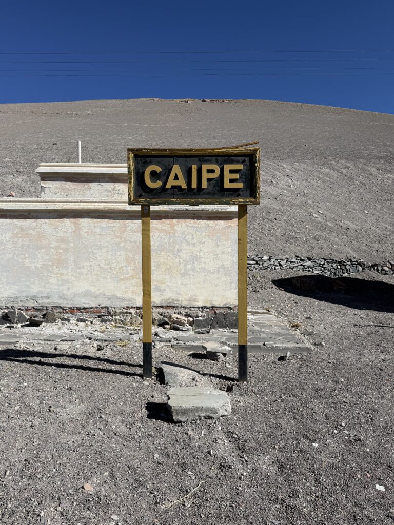
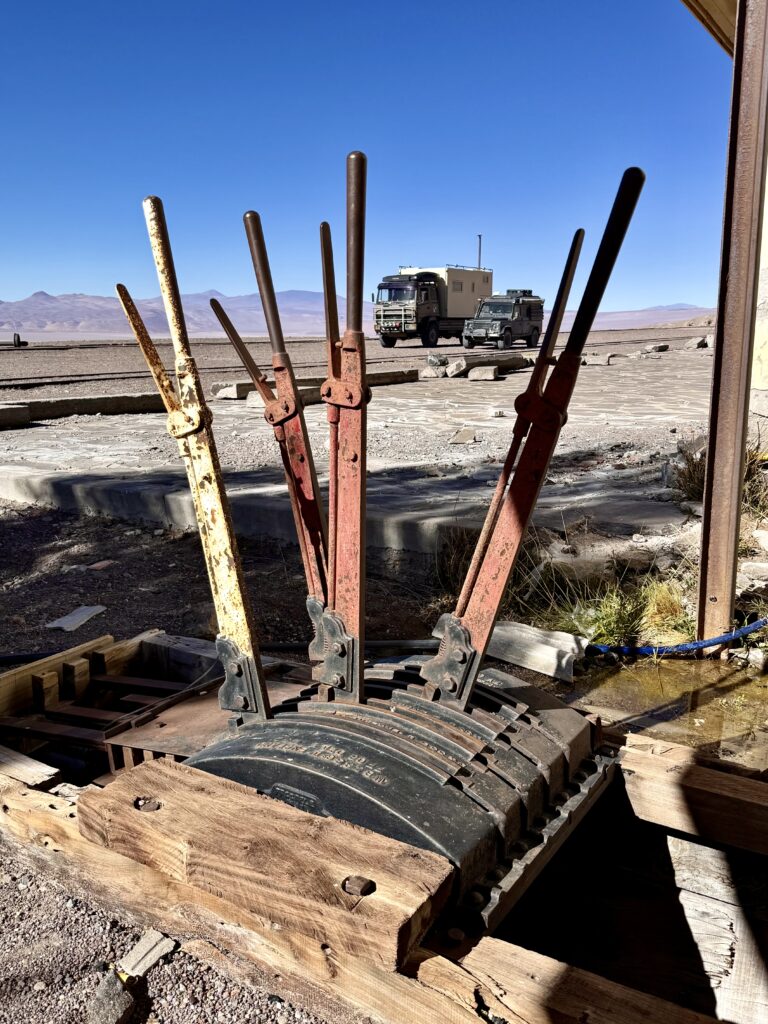
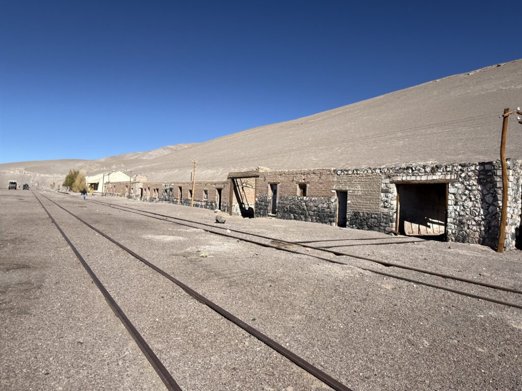
CAIPE TRAIN STATION
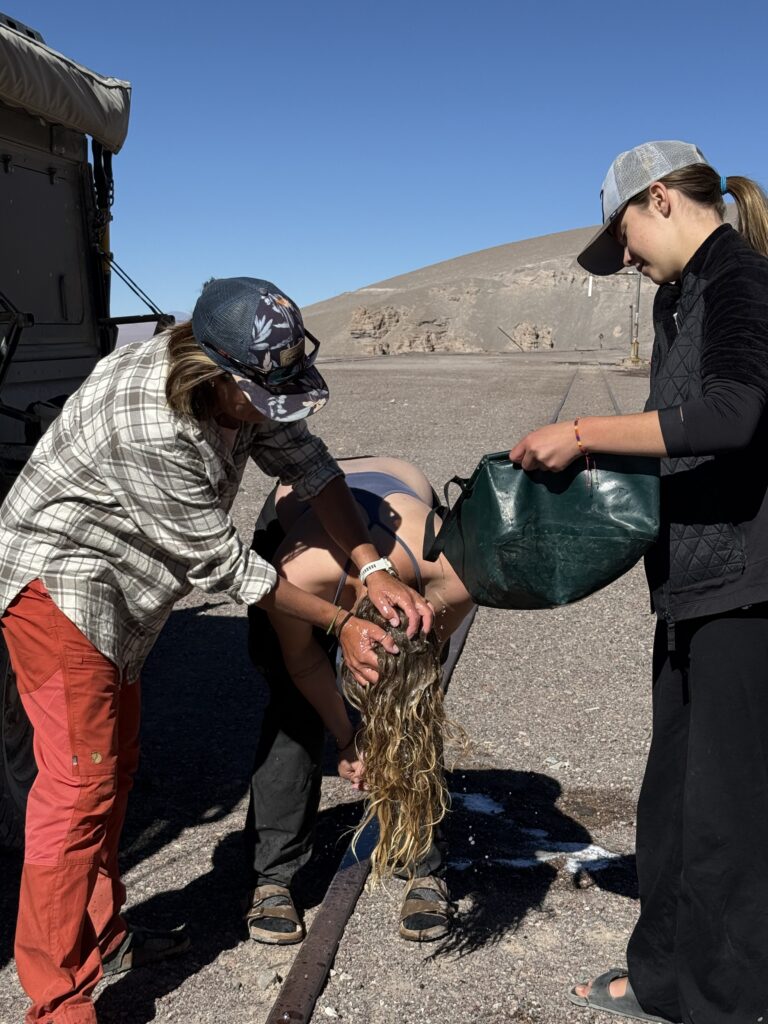
The next day, we explored the abandoned Caipe train station—a relic from the mining days, when this remote region was connected by rail. Used to transport minerals across the Andes, it now stands empty, its tracks long since overgrown, but still with a functioning water tower.
A freshwater tap pouring out glacially cold water. Too cold for a shower, we all washed our hair. Refreshing and painful. Brain freeze included, we dried off in the warm sun.
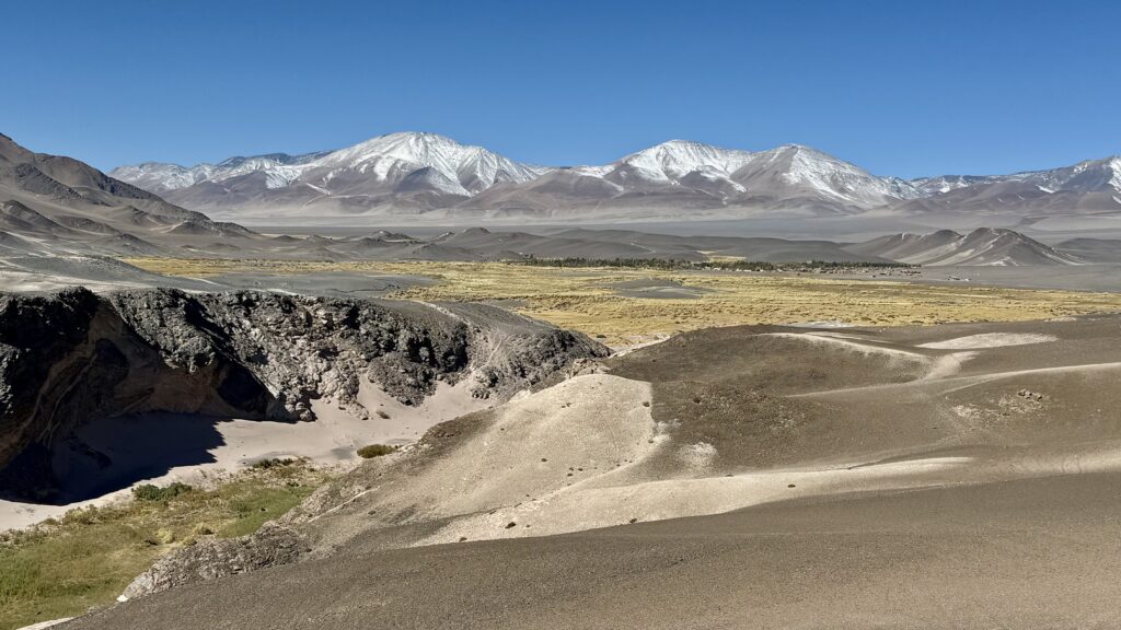
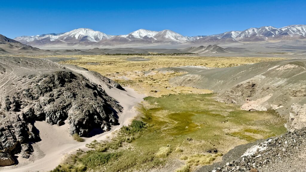
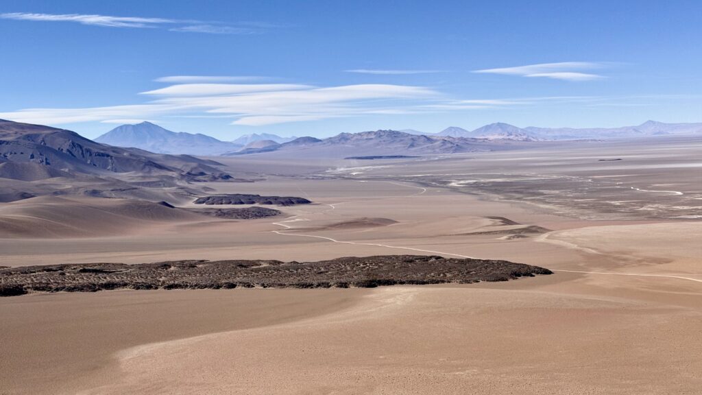
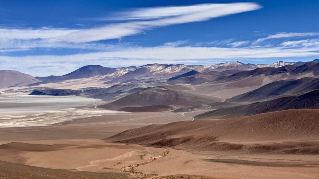
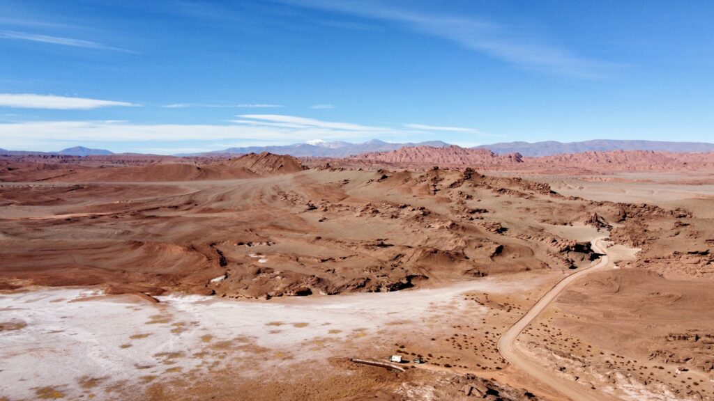
STUNNING LANDSCAPES

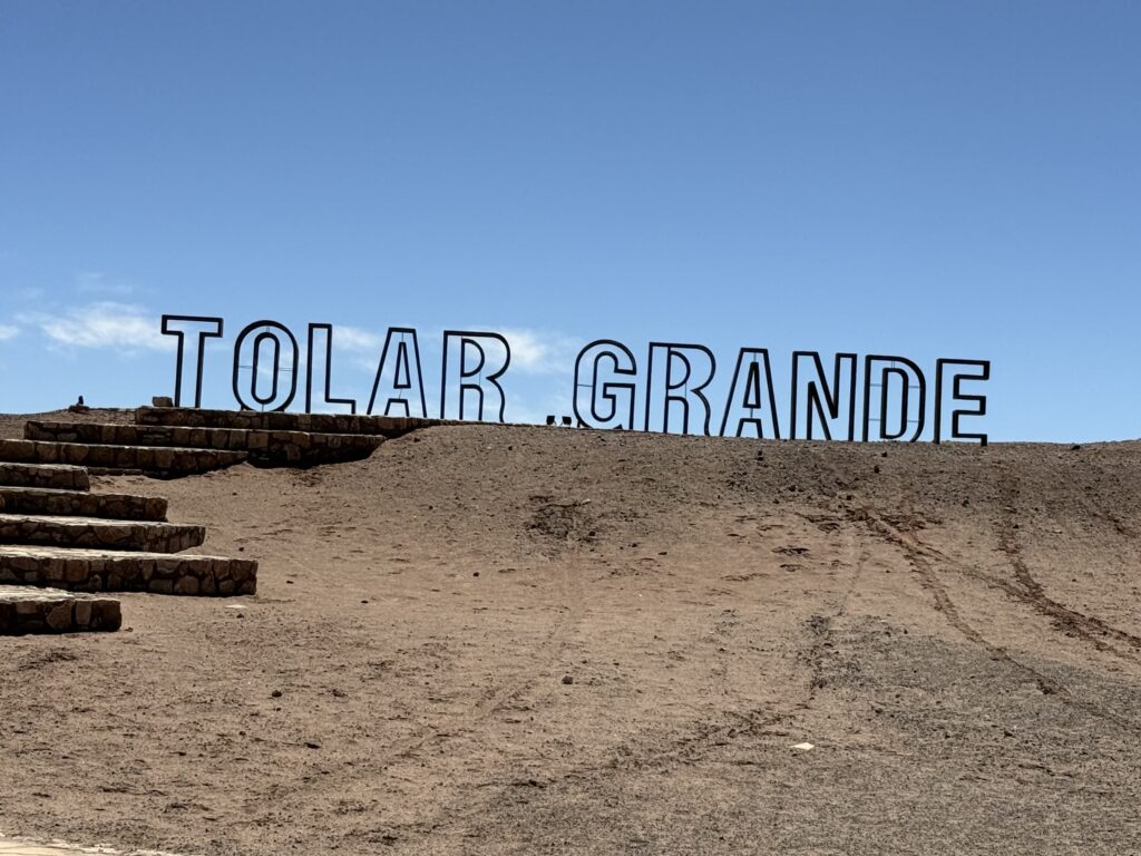
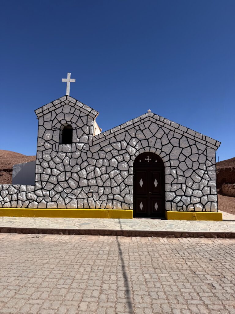
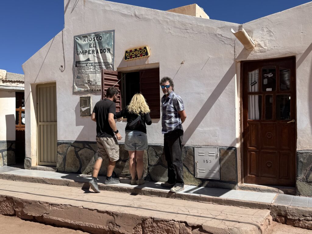
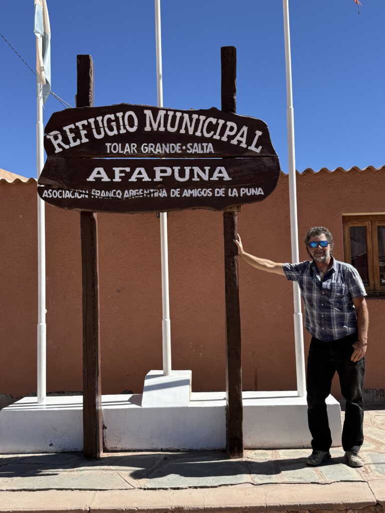
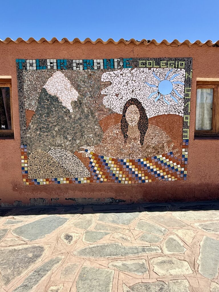
TOLAR GRANDE
The road toward Tolar Grande was punishing—30km of relentless ripio that rattled every bolt in the truck. When we arrived, the town felt almost abandoned. With a population of only a few hundred, it was eerily quiet. Not a soul in sight due to siesta time. We found water and a few cold drinks, and that was about it.
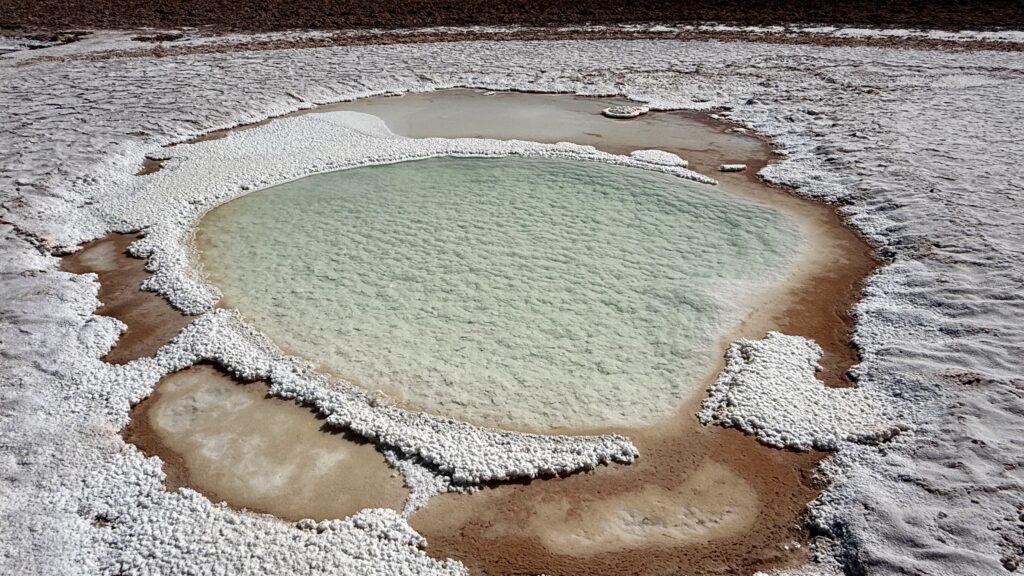
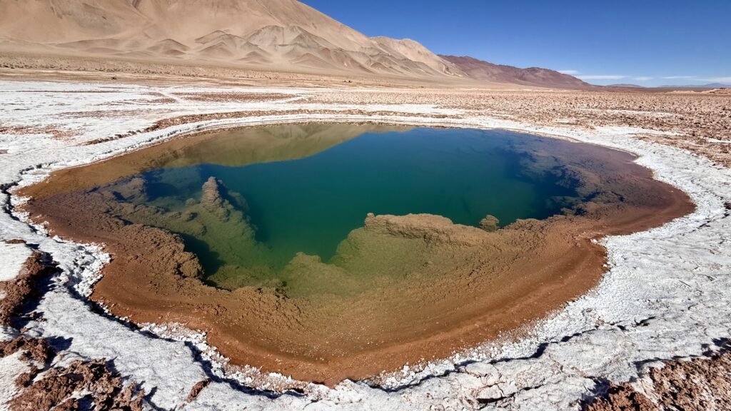
DESERT DEL DIABLO
We ended the day in the Desierto del Diablo—the Devil’s Desert. Leaving Tolar Grande, beyond the pools it was like we turned a corner and entered into yet another dramatically unique landscape unlike another we’ve seen.
First it was almost a teal green dusting on top of red dust. Then it turned into these red rock formations that rose dramatically from the earth, looking like jello desserts or giant sweet breads. Shaped by erosion into soft looking forms. Still up high at 3,500m, we can fill the altitude. The air was cool and dry, at night, the sky exploded with stars. With no moon or light pollution, the Milky Way lit up the darkness.
Evenings became a ritual—more rounds of Dog, a few games of Monopoly Deal, though Dog had firmly claimed top spot.
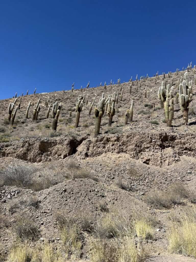
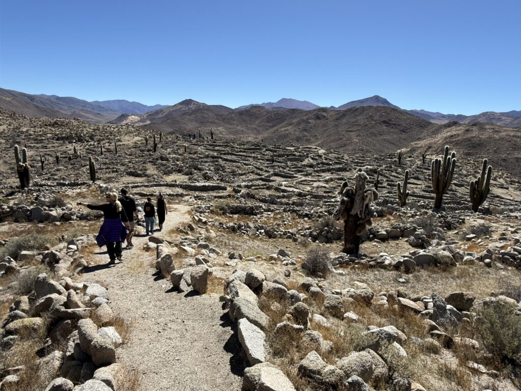
The following day, we wandered through small side canyons before rejoining the main road. Gradually, the landscape began to change. The deep reds faded into softer greys and greens. Cactus appeared. The air thickened. We were descending.
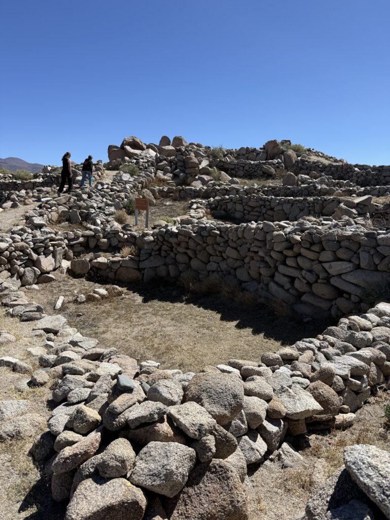
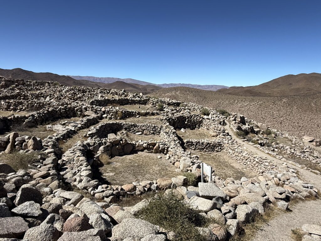
We stopped briefly at a pre-Inca site perched high on a hill. The stone structures, built from heavy, rough granite, spoke of resilience. It’s hard to imagine how people lived here—without easy access to water, in such an exposed place—yet they did.
And then, almost suddenly, the desert gave way. Green returned. Our ears popped as we dropped in elevation. The air felt heavier, humid.
We had arrived in Salta
One Response
Thank you for the lovely long read on my Mother’s Day. I have a detailed map & can follow you.😊👍💕💕